


The rule over Palestine has transferred over time from one side to another as a result of wars and conflicts. In the last two centuries and after being ruled by the Ottoman Empire, the British colonization of Palestine started in 1917. In 1948, the state of Israel was formed over most of the Palestinian land, leaving Gaza and the West Bank to be ruled by Egypt and Jordan, respectively. However, this did not last long, as Gaza and the West Bank were occupied by Israel in 1967. In 1993, after the Oslo I Accord, the Gaza Strip was handed to the Palestinian Authority by the Israeli occupation government, knowing that the control of borders, exportation, and importation was still under the Israeli occupation government. As a result, urban planning in Palestine has been affected and shaped according to these political changes. This article discusses how the political situation has shaped the urban planning of the Gaza Strip and how these changes play roles in the current conflict.
The built environment has been transformed radically since the end of the nineteenth century. For example, land ownership changed from communal during the Ottoman Empire’s rule of the Gaza Strip to private ownership during the British colonization. The agriculture-based economy changed to a wage-based economy, resulting in changes in the architectural forms, construction methods, and the layout of towns and cities. In 1921, the British colonization authority in Palestine issued a town-planning ordinance, followed by an edited one in 1936. The later ordinance had a less centralized system that gave the planning decisions to the local government in each city or district. As a result, a transformation has happened from traditional buildings, such as courtyard houses, to western-style buildings, like multistory mixed-use buildings along wide roads, in addition to the application of modern planning with land use zoning.
In 1948, as a result of the Nakba, the built environment in Palestine was affected hugely. Around 400 villages and towns were depopulated, and thousands of residents were forced to move to other parts inside and outside Palestine. Many of these refugees arrived in the Gaza Strip, which increased its indigenous population by 300%. The population radical and sudden increase in the Gaza Strip affected its urban and rural landscape and added new spatial forms, the refugee camps. Between 1948 and 1967, the responsibility for urban planning in the Gaza Strip was given to the Egyptian government based on the British 1936 mandate ordinance. Housing units and services in refugee camps were given to the UNRWA.
In 1948, as a result of the Nakba, the built environment in Palestine was affected hugely. Around 400 villages and towns were depopulated, and thousands of residents were forced to move to other parts inside and outside Palestine.
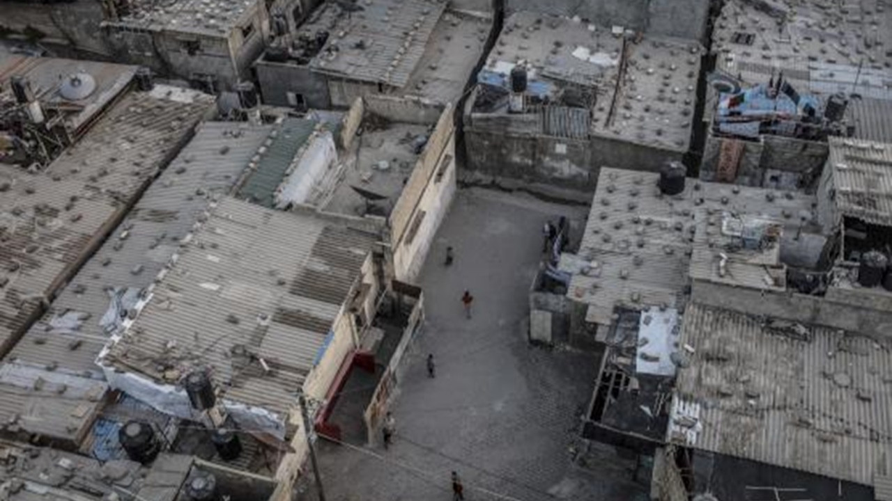
Eight refugee camps have been established in the Gaza Strip; they started with tents and transferred quickly to several solid units with narrow roads in between. These camps as well as the central parts of the main cities in the Gaza Strip represented, and still represent, the architecture of resistance due to both the high density of population and the urban fabric, which is difficult to access by anyone from outside. Therefore, in 1967, after the Israeli occupation of the Gaza Strip and the West Bank, urban planning in these areas was another occupation tool to put more control over Palestinians. In the Gaza Strip, the occupation forces tried to empty refugee camps by relocating some refugees to the West Bank. In addition, the Israeli occupation forces demolished many refugee houses to open a wider road network for military access and control. However, the population’s natural growth in these camps with the limited given area continuously restructures the urban fabric there. This results in seeing multi-story concrete buildings replacing the light structure houses in addition to narrow and ramified roads inside the refugee camps.
The Israeli occupation forces demolished many refugee houses to open a wider road network for military access and control.
After 1967, Israeli settlements were also constructed in different locations in the Gaza Strip. Nearly 21 Israeli settlements were built on the Gaza Strip land between 1968 and 1985. The different locations of these settlements were chosen carefully by the Israeli occupation government to control the borders of the Gaza Strip and also to divide it into three zones: the North and Gaza City, the middle region, and the southern region. This division of the Gaza Strip by Israeli settlements continues to affect the Gaza Strip until today. The settlements were used as military bases as well, and it gave the Israeli occupation army easy access to all urban populated areas from different directions to cut the Palestinian cities and towns from each other. In addition, a new road network, which was accessible only by Israeli settlers, was created. This network, in addition to the settlements, minimizes the land area where Palestinians in the Gaza Strip can build in and inhabit.
In 2005, the Israeli settlements in the Gaza Strip were evacuated as part of the Israeli disengagement from the Gaza Strip. However, that does not improve the situation since one year after the evacuation, a harsh blockade was imposed on the Gaza Strip, preventing the development of the evacuated areas. The blockade prevents building materials from entering the Gaza Strip which left these areas, settlements areas, to be either agricultural areas or open spaces. At the same time, lands inside the Gaza Strip near the eastern borders were taken as a buffer zone, which again limited the areas available for construction, agricultural, or industrial purposes.
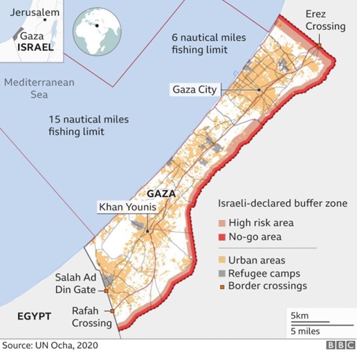
The Buffer Zone along the eastern border of the Gaza Strip (UN OCHA, 2020)
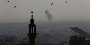
In summary, the current urban characteristics of the Gaza Strip have been shaped by two main powers: the power of resistance and the power of occupation. The power of resistance is represented by the contiguous architecture of both refugee camps and the old parts of all cities forming the Gaza Strip, in addition to the insistence on living and rebuilding better after each attack. The power of resistance can also be seen in the innovation in finding alternatives within the limited resources allowed to enter the Gaza Strip. On the other hand, the power of occupation is represented by the master plan of the Gaza Strip, which turned it into a dividable piece of land for easy control in addition to the control of all goods going in and out of the Gaza Strip. Both of these powers used architecture and urban planning, either intentionally or naturally, throughout the several attacks on the Gaza Strip. In 2014, when the Israeli tanks tried to invade Gaza, they could enter the city from the areas where there were settlements before. Still, they could not invade the center of the city without bombing the entire building fabric in that area. This is what explains the massive destruction we can see nowadays in the urban areas, specifically refugee camps like al-Shati and Jabalia refugee camps or the old part of the city like al-Shuja’iyya neighborhood. Therefore, we can conclude that the current destruction that we witness in the Gaza Strip has been exacerbated by segregation and colonial infrastructure in one of Earth’s most densely populated areas.
